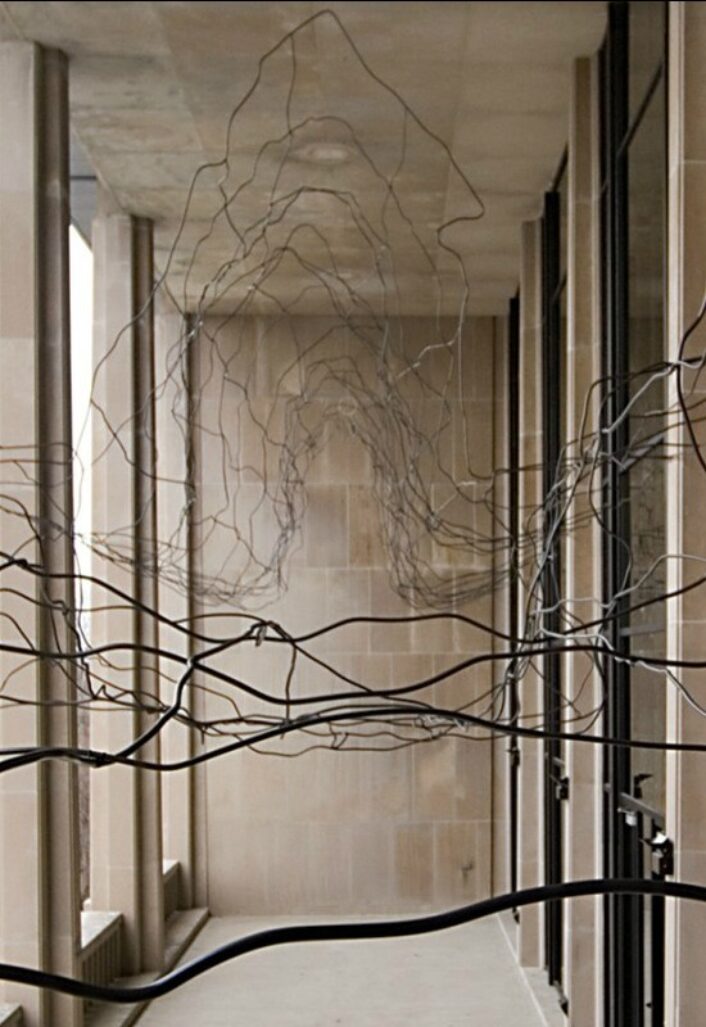
Architecture
Maya Lin’s art landscapes
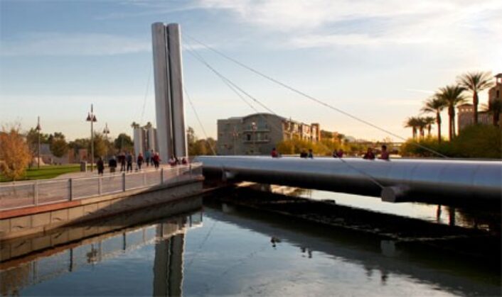
The Vancouver Land Bridge runs over State Route 14, 10 miles north of Portland, Oregon. The road reconnects the Columbia River with the ancient Klickiat Trail which has been used by Northwest tribes for thousands of years.
Image courtesy of: Yanglm 2008
Oregon’s Confluence Project is a daunting undertaking that initially began as a way to connect people to history, living cultures, and the ecology of the Columbia River system with the help of Northwest tribes people. The project was meant to educate the public about the significance of the river and to counter the myth that Lewis and Clark discovered this land.
The landscape around the Columbia River Basin has been shaped by millions and millions of years of volcanic basalt, and further sculpted by flowing rainwater and snowmelt. In addition, the lands and rivers were also shaped by local cultural traditions that have been handed down by countless generations. Those tales provided ways to pass down education, rules, and the tribes’ ways of life in an effort to support the natural environment rather than harm it.
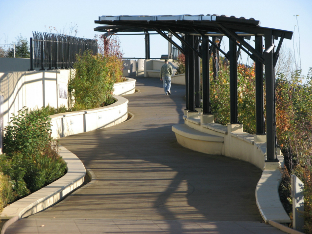
The earth-covered pedestrian bridge is lined with indigenous plants and Native basket weaving decorations. The bridge reconnects historic Fort Vancouver with the river’s waterfront.
Image courtesy of: Scenic Washington
The land bridge was designed via a collaboration between Maya Lin and Johnpaul Jones, an architect most recognized for his work on the National Museum of the American Indian in Washington. This land bridge, completed in 2008, is the project’s highlight. As Jones said (courtesy of The New York Times), “We grabbed the prairie and pulled it over the highway.”
The earthen-covered pedestrian bridge arcs beautifully over State Route 14, it is supported by over twenty separate retaining walls. At forty-feet-wide, it is the largest of the six public “art landscapes” the Confluence Project commissioned Lin to design along this long stretch of the Columbia River. The six sites along the 438 miles were specifically selected to mark an important spot (or confluence) where bodies of water converge… or maybe it is the cultures that are converging?
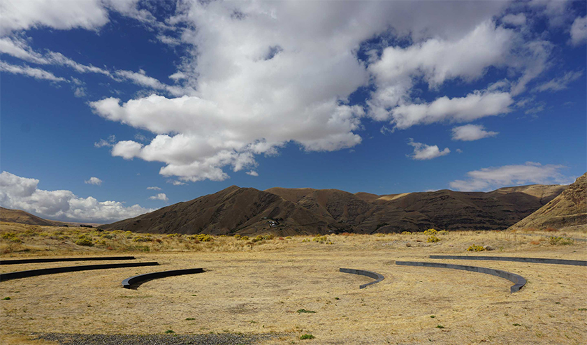
The Listening Circle Amphitheater at Chief Timothy Park. The setting is on an island in the Snake River.
Image by Chris Lonigro courtesy of: The Confluence Project
Antone Minthorn, chairman of the Confluence Project board and a member of Confederated Tribes of the Umatilla Indian Reservation, told Alex V. Cipolle (courtesy of The New York Times) “The Confluence Project built that bridge. You begin to wonder well, what is our legacy?” He went on to add that educating non-Indigenous people about the history of Native peoples’ history about this place is part of everyone relearning what it means to “become American” and asking how can we all protect and enjoy this land together?
He believes that the end goal is to create art-scapes that are in direct harmony with the landscape; ones that whisper, “just because you can’t see us all the time doesn’t mean we aren’t here.” Minthorn continues, “The education of non-Native people about the Indigenous history of this place helps them to become more from this place, and of this place.”
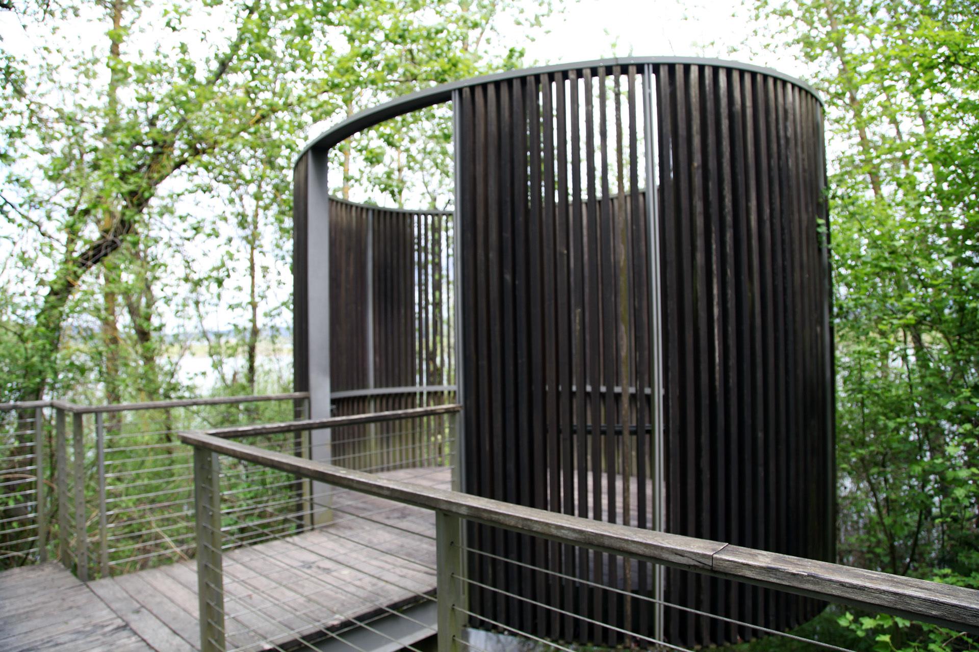
Bird Blind Site.
Lin hopes that as the restored landscape matures, a forest will grow to surround the art and bring more birds to the site organically.
Image courtesy of: OPB
One of the art landscapes is the Bird Blind; it was inspired by a quote that is over two hundred years old. Maya Lin was intrigued by William Clark’s reporting of his lack of sleep because of the “horrid” racket made by the area’s many birds. During the rehabilitation and restoration of the Sandy River Delta, Lin became interested in building a bird blind. The design, just off the main path, consists of a gently-sloping ramp to the art that is elevated on concrete columns. The handrail’s wood top is engraved with a quote from a Corps of Discover journal which dates back to 1805. Thin slats made from black locust wood are spaced apart to form the blind’s walls; they provide an airy appearance that allows for visitors to view the birds and animals in their natural habitat without disturbing them. Further paying homage to the past, each slate is inscribed with the names of the birds and animals the Corps of Discovery wrote about. Lin made sure that these inscriptions were made at eye level. Finally for each species, the text along the slat lists three things, the common name, the scientific meal, and the current state: extinct, endangered, recovered, or flourishing.
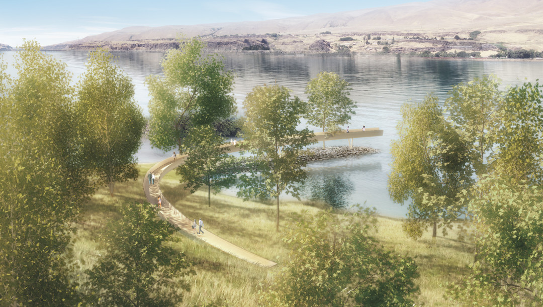
A rendering of Lin’s Celilo Arc.
Image courtesy of: Seattle Met
There is one more art-scape to make and it is on hold until everyone involved can be in agreement. Linn designed for a project at Celilo Falls. The Columbia River tribes have long considered Celilo Falls to be a sacred area because of the abundance of salmon which ensued a site with a rich tribal history of fishing, culture, and trade. Some estimates say that these events date back 16,000 years. Sadly, a 1957 project by the U.S. Army Corps of Engineers flooded the falls. In turn, the Dalles Dam inadvertently alternated salmon migration and spawning. Sadly, the dam destroyed many villages… stripped them of their livelihoods.
Lin was asked to design a fitting project for this site; she decided upon the Celilo Arc, a 500-foot pathway over the water which honors the native fishing platforms that once stood in those same waters. Even though the project’s design has the approval of the Confederated Tribes of Warm Springs, the Confederated Tribes of the Umatilla Indian Reservation, and the New Perce Tribe, the Yakama Nation believes that this seventh site could cause additional damage to the fragile area. Until there is a consensus among all the affected tribes, the U.S. Army Corps of Engineers agreed to put this project on hold. We hope all interested parties will find common ground soon because the renderings are exciting!